
Utility poles and towers are a fundamental piece of infrastructure for power and telecom utilities. However, it can be difficult to know all condition aspects of a structure and its attached equipment for maintenance-planning.
Light Detection and Ranging (LiDAR) data collected by either Mobile, Terrestrial, Airborne, or a combination of all three collection methods, can make things easier for utility providers and contractors.
LiDAR produces millions of data points to create three-dimensional (3-D) images. Historically, it has helped create 3-D maps of terrain as well as the planimetric features within a project area. It’s also used by Google to construct building images on Google Maps. The technology that helps visualize tall buildings when you are navigating around a city can also help utility providers maintain their structures.


Examples of LiDAR images.
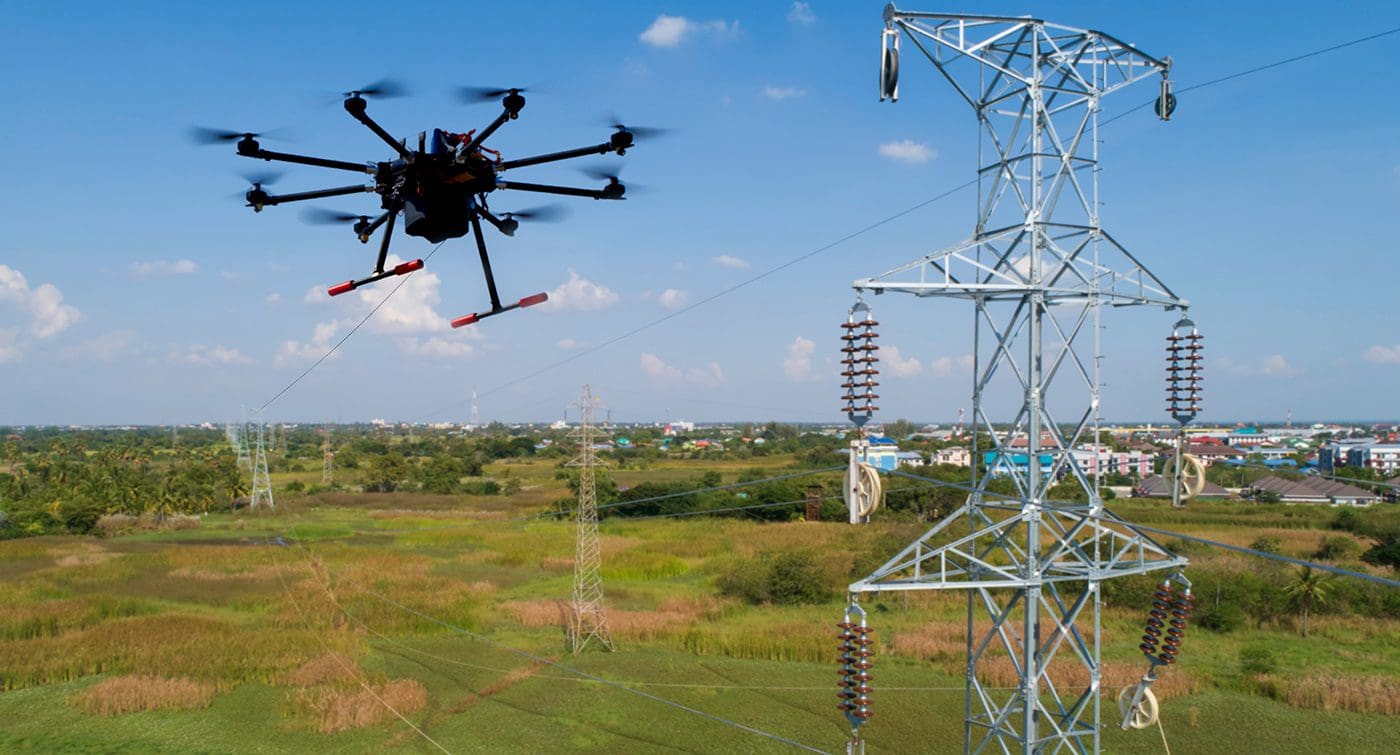
What Role Do ‘Drones’ Play in LiDAR?
Unmanned Aerial Vehicles (UAVs), more commonly known as drones, can collect LiDAR data, thermal imagery and color photography of features and locations that would otherwise be expensive and/or dangerous for maintenance workers to access and inspect in person.
For example, it is now becoming popular for Departments of Transportation across the US to use drones for bridge inspections.
Without drones, inspecting a bridge requires the use of specialized and expensive equipment such as bridge cranes.
When cranes are not used, trained and certified personnel deploy on top of the structure, establishing critical anchor points to safely and dependably hold ropes for a worker to climb down to examine the side and underside.
As an alternative to this approach, a drone can be safely utilized by a two-person crew (Pilot and Observer), positioned safely away from any hazards to capture all required structure features.
When used to inspect utility poles, a drone can quickly canvas the area, collecting the data that would otherwise require workers to traverse challenging terrain and potentially hazardous working conditions.
The data that the drone collects is also digitized and transferable over wireless connection, making it easier to set up for analysis.
LiDAR-Enhanced Utilities Data
When used alongside a data synchronization framework like Rizing Mercury, LiDAR data can be used to populate SAP asset registry data.
Rizing Mercury allows for full integration with GIS platforms such as Esri. This in turn allows for a more in-depth look at each individual structure, and the ability to model a Digital Twin.
If a new pole is installed, this can be reflected immediately within a GIS solution like Esri, with asset data also created in SAP. Once this consolidated asset record exists, both spatial and tabular data attributes are available; the asset can be viewed in SAP, and the data used to drive maintenance actions within SAP.
There’s even potential to integrate with consumer apps such as Google Street View to create a more holistic view of the asset and allow maintenance teams to virtually drive along a road and see the environment around structures without a physical trip to the area.
Better Data, Better Maintenance
With LiDAR providing a deeper level of information on pole and tower conditions, as well as potential impacts of their location, it becomes easier to plan pole and tower maintenance.
Instead of scheduled pole and tower replacements (typically driven by standard degradation indexes), which may be planned at times when a pole does not need to be replaced or when a pole has degraded past the point of replacement, poles can be monitored and replaced only as needed.
This helps utilities more efficiently maintain their pole and tower infrastructure and create safer work environments, while also limiting disruptions of service to customers.